

I find that so crazy. I’m German and for us Italy is always the sunny south where it gets much too hot for us. The USA iseems more like us climate-wise. I’d always thought New York would be a little like Berlin. Crazy to see how far south most of the US actually is.
AMOC doing some heavy lifiting
https://en.wikipedia.org/wiki/Atlantic_meridional_overturning_circulation
Also the Mediterranean acts like a huge heat buffer. It basically stops the polar winds from reaching southern Europe.
In addition to there being a huge mountain range in the way. The Alps block/slow down a lot of the cold air currents that do make their way down from the polar regions. That’s why cities like Turin and Milan still have cold climates in the north. Cold air still makes it’s way over the Alps but is slowed and is reheated as it travels south so cities like Genoa/Florence/Rome are much milder in the winter.
A large part of it is also simply the fact that at the midlatitudes westerlies dominate, which means that western Europe receives mild air from the ocean, while the US east cost receives more extreme weather from the continent.
That one is getting phased out though.
Yeah I’ve been getting deprecation warnings about that every time I start
./the-beachIt still has a runtime dependency on AMOC
Europe is so fucked when climate change wrecks the AMOC by melting too much ice into the north Atlantic
I don’t think there’s any climate change scenario that’s still plausible that doesn’t melt the Arctic, and I don’t think there’s any way for the Arctic to melt without wrecking the AMOC
The crazy bit is how far north Europe is, relative to the climate we get. Almost everywhere else this far north is freezing
Imagine the chaos in Europe if the ocean currents fail to bring warm temps up from the tropics and the UK, Germany, etc all start to get weather similar to mid-northern Canada which even Canadians try their best to avoid.
The US is fucking huge. A lot of our weather up north is closer to yours, but we’ve got deserts, rainforests, Florida is just outside of the tropics, etc. There’s a huge variety of climates here. The US is larger than all of Europe, by quite a margin. East to west it’s wider than Lisbon, Spain to Moscow, Russia. North to South it’s pretty much identical to Europe. (Technically Europe is slightly larger with the Scandinavian countries sticking out pretty far north.)
The US is fucking huge…The US is larger than all of Europe, by quite a margin
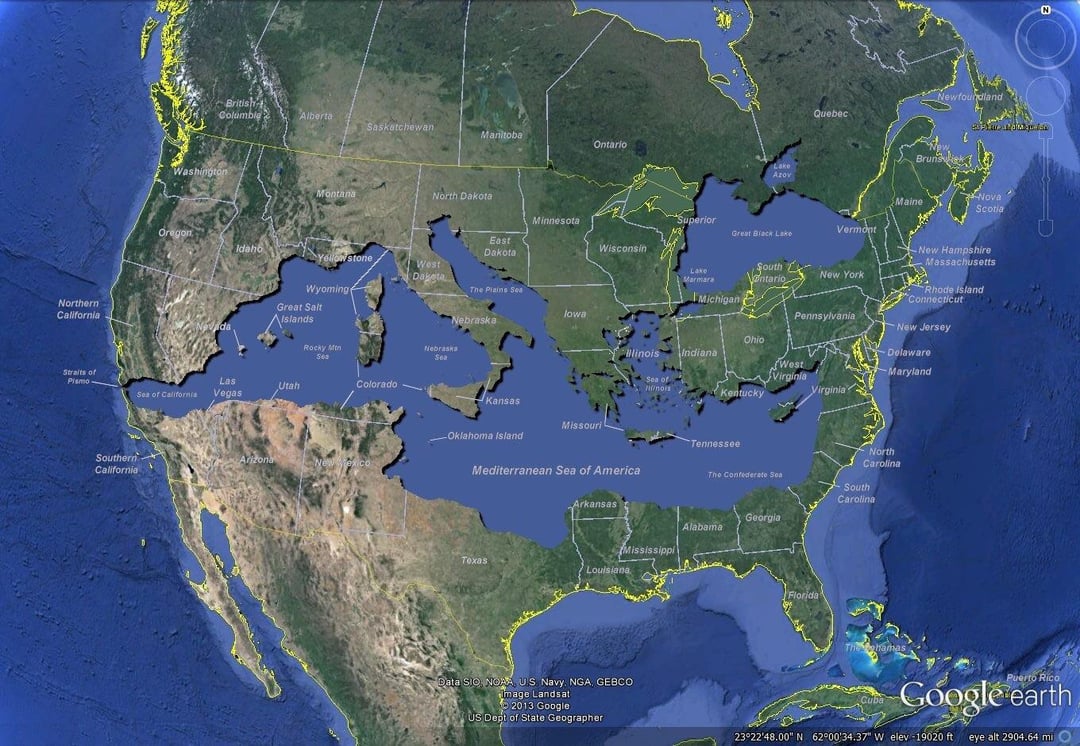
It is hilarious to imagine if this were real. Like what would European explorers and Settlers have done if they started mapping it out and went “wait a minute…”
Looks like a huge improvement
I mean, you’d lose most of the Appalachian Mountains which as one of the oldest mountain ranges in the world means losing a ton of ancient fossils that helped piece together the biological history of Earth. I’d also be curious how the glaciers would be impacted given how heavily they shaped much of North America
You also lose several major cities including Toronto and St Louis, Canada loses most of its habitable land (assuming the climate isn’t significantly impacted by the existence of a second Mediterranean Sea, which it definitely would be) Chicago is going to be quite different but probably an even more important port city in such a world. Las Vegas is now a port city, so probably less casinos and more just major city. My wife would be sad because the Quad Cities (a metro area on the Iowa/Illinois border) wouldn’t exist and she really likes that area. I’d be sad because the Mississippi River would be much short and therefore way less cool. But it’s a really wild concept that gets crazier the more you think about it
Lisbon is in Portugal btw. (But that doesn’t change the distances.)
Shit, you’re right. Too much EU5 playing as Castile, and then Spain, capturing Portugal.
I like to point out that New York to LA os essentially the same distance as Moscow to Lisbon, while Seattle to Miami os about the same as London to Baghdad. That’s why St. Louis was the furthest west MLB team until the 50’s. The logistics for US sports are insane
The weather in New England and upper New York is very much like German weather, and sometimes worse. We’ve had snow on the grounds since the 30th of November and it’s only barely reached 0C in the last week.
It was -15C a couple nights ago at roughly the latitude of Rome, next to the ocean too. And only about 50km northwest (inland) it went down to -25C.
This has been a colder December than average for the last decade, but we have mountains that regularly get meters of snow each winter, and they are way lower elevation than the alps too. Also as we all know the last decade has been stoopid warm.
Mt Washington has measured the highest wind speed in the world.
The USA iseems more like us climate-wise.
You’d think that knowing about Texas, New Mexico or Nevada? You probably have seen how it looks around Las Vegas at least.
based on what i remember, NJ (and NYC) had weather pretty similar to budapest. now, i’ve never been to berlin but i cant imagine it’s that different from budapest, just a bit colder.
so yeah, their weather is weird :)
I always pictured Berlin as like the Midwest but with less tornadoes
great place to grow olives though. as many places with mediterrenean climates are.
New York is in line with Lisbon more or less
Gibraltar is about the same latitude as the Virgina/North Carolina state line. So southern Europe essentially ends halfway down the US Eastern seaboard
Ocean currents do a lot more to even out the weather
Yeah thank you to the gulf stream. Too bad that global warming will make it disappear ¯\_(ツ)_/¯
Also wind patterns. At the midlatitudes westerlies dominate. So the east coast has a continental climate (receives cold air in the winters, hot air in the summers) while the west coast does not (the oceans make the summers and winters mild)
You’ll see that the west coast cities on the same latitudes of their European counterparts have a very similar climate (as opposed to east coast cities, which have a very different climate than their latitude-counterpart).
So do the Great Lakes. Although, currently the lakes are generating their own weather.
This is also a really great illustration of colorblindness. I actually didn’t even see Italy until I read the comment about the boot.
Thanks, didn’t realize until I read this lol

Secketly?
I have some bad news for you…
Secretly loathe. Look at it full size, the k is really an r

I was just thinking about this regarding climate the other day and found this interesting graphic on climate similarities in North America.
Were they limited in colours?
More than 4 colours? In this economy?
I’m aware of it, but it doesn’t work on this where non-connected pieces can have the same climate.
Further the size and proximity of Scandinavia as well as the darkness and size of Ukraine make them difficult to distinguish.
Too many colors on a map looks busy, as long as none are touching with the same color then it’s good. In fact, the fewest number of colors you can use without any touching is usually the best
Even suggesting that either mexico or india have a single climate is crazy to me
I don’t think it’s implying the boundaries are singular climates. I think it’s more like “the variance of climates in this area are similar to the variance of climates in this other country”. It’s a bit hard to see, but there are names of cities labeled on the map as well. I’m not sure how accurate it is, but I’m inferring that Shanghai and Tokyo have similar climates to each other because they’re very close on the map in NC.
Philly, which lies in the japan part of this map, has a real nice cherry blossom festival. Im sure it lacks in comparison to Japan at the right time of year, but still its pretty dope. And yea philly has cherry blossom trees randomly sprinkled about.
ngl that could be a real map of territories after Trump is done cutting the US up and handing out the pieces to his buddies abroad.
Trippy pic bro
Everybody’s wrapped up in the climate / weather discussion, but the thing that surprised me a bit more was the difference in sunset / sunrise.
I was working on an international team (i.e. a bunch of Americans + one dude from France).
Back in those ancient times, video calls with everybody’s face included weren’t necessarily the standard, and even when we did them, everyone was typically in an office environment.
Anyway, one late afternoon (for us in the USA) we did a team video call and our French counterpart was sitting outdoors in his back yard and it was still light outside. Although we knew it was 10 p.m. where he lived, it looked closer to the amount of sunlight we’d typically see around 7 or maybe 8 p.m. here in mid-latitude US.
It was kind of interesting, because even in the height of summer at the very highest elevations, it’s going to be very dark here at 10 p.m.
Location in the time zone is also a factor. France is near the far west of CEST.
For example Michigan is in the far west of EST. The sun rises 30-40 minutes later than in New York, and you do get light at 10pm in the height of summer.
This was a cool thing about living in Seattle and any further north - in the summer it’d be dusk until 10pm. And the in the winter the sun would basically never appear. I guess it was less “cool” and more “insanity producing” but locals were used to it.
As a kid, I hated going to bed at 9:30 because the sun was still up
Cameras are pretty good at taking in light and giving a false representation of how you’d experience it if you were actually there. You see it at televised sporting events where it looks like twilight but they have to tell the viewers at home that it’s full dark there. I’d imagine at 10pm, his web cam was just doing a much better job seeing than a human eye could.
I live just across the Canadian border (
belowjust above the 45th parallel) and it’s pretty bright at 10PM here also (that is around the summer solstice of course). So while the camera/software might have been boosting brightness, the difference in latitude still seems to make a big difference!
yeah, 16 hours of daylight during summer means even more time for the daystar to hammer us with its heat. and the flipside is 8 hours of sunlight during the winter and it getting dark by 4pm.
but those long, bright summer evenings are nice when it’s not 2138219219 degrees.
I dislike that the sun and shadows move the wrong way in Minecraft with the shaders I have used (vanilla the sun goes straight above east to west like you’re in the tropics)
The sun in the real world rises to my right and sets to my left (in winter it rises in the north-east and sets in the north-west)
I’m tempted to modify the mod to make the sun move correctly.
Most of the world’s population would disagree with me
Comparing similar latitudes in north america to where i live in sweden is a wild experience. The average temperatures are double, sometines almost triple, during summer.
On which scale? Because that kinda matters.
Celsius? Kinda hot but not necessarily deadly.
Kelvin? You’ve turned your city into an air fryer.
They live in Sweden so Celsius
It’s still an odd way to compare temperatures:
- Double of 1 degree is 2 degrees, so not very different.
- Double of 30 degrees is 60 degrees, so wildly different.
- Double of -20 degrees is -40 degrees, so a lot colder instead of warmer.
This is an example I use when I teach data types. It happens because the scale (F or C) is an “interval” scale. Its zero is not based on the absence of the property it is measuring, so you can’t apply a multiplicative transform to it like, “double”.
It is like lining up by height, calling the shortest person the standard and measure height of everyone else from that. So, the next tallest might be 2 cm, the next 4cm. But clearly the person we are calling 4cm is not twice the height of the person we called 2 cm.
Even if the scale was aligned with absolute zero - like Kelvin - it would not be able to describe temperature changes in the multiples primarily because our FEEL of temperature is what matters here. And since humans live in the approx. temperature ranges of -40 to 80 (using an extended range to cover cases like the Arctic/Antarctic stations, or saunas), the best scale to use would be a Celsius scale shifted somewhat to make 0deg the most optimal neutral temperature - which is, in my opinion, 16 degrees Celsius.
Ha, while funny it still doesn’t work. If we use an interval scale with zero degrees Lat defined as 16 degrees Celsius, how many times hotter is zero degrees Lat than-1 degrees Lat? If you are using “temperature comfort” as your underlying property, zero had to be the university defined “lack of all comfort” which I don’t think you will find. Subjective comfort is notoriously difficult to make into ratio scale. Pain measurement is a well- known example.
People in very cold temperatures protect themselves from the cold. No one lives in a sauna. Few live where it gets much over 40°C, those who do typically protect themselves from the heat as much as they can.
It’s probably more true that humans live between 0 and (low humidity) 40° without protection, but neither of those close in time, it takes adaptation to tolerate either end of those extremes
That wasn’t the point though… -40 to 80 is the APPROXIMATE range a person would want to describe in terms of “oh it’s twice as hot/cold as yesterday”, which is the whole point of the exercise, not to determine at what temperatures humans use protection against the weather, because guess fucking what, we protect our bodies even in optimal temperatures and weather conditions! Or do you walk around fully naked when the weather’s just right?
I mean thats completely valid criticism but it had a lot of shock value still.
Yes, the difference in temperature is interesting, I don’t want to seem dismissive of that. Just the choice of wording was also interesting.
yes
You’d think so, but without specifying the scale… it could be anything. ANYTHING!
Probably bananas though, according to my middleschool math teacher
Ever visit Phoenix?
On which scale? Because that kinda matters.
The rate of sweat I produce, in terms of ml of sweat per minute.
Which way? Because it gets incredibly hot in the Canadian prairie. There is no body of water to regulate temperature so the summers can get serious heat waves while the winter is absolutely frigid. Granted, Edmonton is still considerably further south than Stockholm.
All the immigrants from Southern Italy coming to New York:
“It’s the same latitude, it’ll be just like home!”That actually really fucked up the first French attempts to settle the St. Lawrence river. They knew it was a similar latitude as Paris so they were completely unprepared for their first winter in Quebec City.
Why… why is Philadelphia spelled with an “F”?
Virginia Occidentale has a nice ring to it. It’'d fuck up John Denver too.
🎵 Portami a casa, vie di campagna 🎶
It’s translated into French it looks like.
Did you not notice “Virginia Occidental”?
It’s Spanish, no? Philadelphia in French is Philadelphie.
my guess is Italian, in Spanish it would have been “occidental”
It is italian
Maybe so. I checked against Italian and it wasn’t that. Occidentale would be “Western” in Spanish and “West” in French, so tjat tjrew me off.
But as others said, no translation of “New”?
Is…is the map trolling us?
They translated “west”, but not “new”.
In Italian we said Nuova York until, let’s say, the sixties. Virginia Occidentale is quite uncommon too, I have to say. It’s more common simply West Virginia.
People used to translate more than today
translation of names can get pretty arbitrary. eg, which “new”-s would you translate among these: new york, new zealand, new hampshire, newfoundland?
Right? This map is so weird.
It’s really fucking with me that almost everything is the exact same except for Filadelphia and Virginia Occidental. Just enough to look the same in English with like 2 tiny differences
The meme maker was threatened with a cease and decist order by Kraft-Heinz.
Why would you spell it with a ph?
Because thats how it is pronounced
Italian doesn’t make that sound in any way except with “f”
The US could indeed become the next italy, politically
a once great empire that crumbled
Italy was never a great empire.
Modern Italy does argue that it is the proper successor to the Roman Empire, but if you do look at the history of the nations (and city states) that rose and fell between the split of the Roman Empire into West and East/Byzantine around 395, and the formation of a unified Italy in 1861, that’s a bit of a stretch.
I already knew. My dad lives in southern France and naar him is a sign near the road where the 45th parallel crosses.
That’s the border between the states and Canada…
deleted by creator
For context this puts Rome about north enough to get snow hurricanes were it on the American east coast
oh, does Italy not usually get snowstorms with cyclone structures
Well it does get snow.
The Mediterranean is an incomparably peaceful and small sea.
This is related to why the French settled in Quebec iirc. The French king didn’t want to send settlers too close to already-established Spanish colonies such as Mexico or Florida, so he ordered that French settlers would settle in the Americas at the same latitude as the métropole, as he thought the climate would be the same.
Amazing. Where did you read this?
I know it’s mentioned in the book ‘a thousand years of annoying the french’, along with all of their other British related colonial mishaps. Great read!
I thought the boot was supposed to go below the mitten
The west coast city I live in is just a little further north than Philadelphia and has a very Mediterranean climate so this puts that into perspective for me.
So thats why there are so many Italians in south philly


